
|
David William Leverington I study the surface processes and landforms of Earth and of other solid bodies of the solar system. Courses taught in the Department of Geosciences: |

CAREER AND EDUCATION
|
2011-present 2005-2011 2001-2005 2001-2001 1996-2001 1993-1995 1988-1992 |
|
RESEARCH CONTRIBUTIONS IN JOURNALS AND BOOKS Leverington, D.W., 2023, Large volcanic channels of the inner solar system. Oxford Research Encyclopedia of Planetary Science, doi:10.1093/acrefore/9780190647926.013.261. [link] *Berman, D.A., Leverington, D.W., 2023, Constraints on the effusive volcanic eruptions that formed Kallistos Vallis, Venus. Geomorphology, 435, 108752. [link] Leverington, D.W., 2022, Development of Shalbatana Vallis (Mars) by dry volcanic processes. Planetary and Space Science, 215, 105464. [link] Leverington, D.W., 2021, Dry megafloods on Mars: Formation of the outflow channels by voluminous effusions of low viscosity lava. Chapter 4 in Mars Geological Enigmas, Elsevier. [pdf] Leverington, D.W., 2020, Incision of Ma'adim Vallis (Mars) by dry volcanic megafloods effused from multiple highland sources. Planetary and Space Science, 191, 105021. [pdf] Leverington, D.W., 2019, Formation of Ares Vallis (Mars) by effusions of low-viscosity lava within multiple regions of chaotic terrain. Geomorphology, 345, 106828. [pdf] Leverington, D.W., 2019, Constraints on the nature of the effusive volcanic eruptions that incised Ravi Vallis, Mars. Planetary and Space Science, 167: 54-70. [pdf] Leverington, D.W., Schindler, M., 2018, Delineating areas of past environmental degradation near smelters using rock coatings: A case study at Rouyn-Noranda, Quebec. Scientific Reports, 8: 17364. [pdf] Leverington, D.W., 2018, Is Kasei Valles (Mars) the largest volcanic channel in the solar system?, Icarus, 301: 37-57. [pdf] Leverington, D.W., Schindler, M., 2016, Detection and mapping of black rock coatings using Hyperion images: Sudbury, Ontario, Canada, Remote Sensing, 8: 301. [pdf] *Malcolm, K.J., Leverington, D.W., Schindler, M., 2015, A Landsat-based study of black rock coatings proximal to base metal smelters, Sudbury, Ontario, Canada, International Journal of Remote Sensing, 36: 3932-3960. [pdf] Leverington, D.W., 2014, Did large volcanic channel systems develop on Earth during the Hadean and Archean?, Precambrian Research, 246: 226-239. [pdf]; revised Fig.1 here and here. *Hopper, J.P., Leverington, D.W., 2014, Formation of Hrad Vallis (Mars) by low viscosity lava flows, Geomorphology, 207: 96-113. [pdf] Leverington, D.W., Moon, W.M., 2012, Landsat-TM-based discrimination of lithological units associated with the Purtuniq ophiolite, Quebec, Canada, Remote Sensing, 4: 1208-1231. [pdf] Leverington, D.W., 2011, A volcanic origin for the outflow channels of Mars: Key evidence and major implications, Geomorphology, 132: 51-75. [pdf] Leverington, D.W., 2010, Discrimination of sedimentary lithologies using Hyperion and Landsat TM data: A case study at Melville Island, Canadian High Arctic, International Journal of Remote Sensing, 31: 233-260. [pdf] Leverington, D.W., 2009, Reconciling channel formation mechanisms with the nature of elevated outflow systems at Ophir and Aurorae Plana, Mars, Journal of Geophysical Research, 114: E10005, doi:10.1029/2009JE003398. [pdf] Leverington, D.W., 2007, Was the Mangala Valles system incised by volcanic flows?, Journal of Geophysical Research, 112, E11005, doi:10.1029/2007JE002896. [pdf] Thompson, T.W., Campbell, B.A., Ghent, R.R., Hawke, B.R., Leverington, D.W., 2006, Radar probing of planetary regoliths: An example from the northern rim of Imbrium Basin, Journal of Geophysical Research, 111: E06S14, doi:10.1029/2005JE002566. [pdf] Leverington, D.W., 2006, Volcanic processes as alternative mechanisms of landform development at a candidate crater-lake site near Tyrrhena Patera, Mars, Journal of Geophysical Research, 111, E11002, doi:10.1029/2004JE002382. [pdf] Duguay, C.R., Zhang, T., Leverington, D.W., Romanovsky, V.E., 2005, Satellite remote sensing of permafrost and seasonally frozen ground, In Remote Sensing in Northern Hydrology: Measuring Environmental Change (C.R. Duguay and A. Pietroniro, Eds), Geophysical Monograph 163, American Geophysical Union, pp.91-118. [pdf] Leverington, D.W., Moon, W.M., 2005, On the use of consensus algorithms to address variability in the results of neural network classifications: Preliminary tests involving two northern study areas, Canadian Journal of Remote Sensing, 31: 269-273. [pdf] Clarke, G.K.C., Leverington, D.W., Teller, J.T., Dyke, A.S., Marshall, S.J., 2005, Fresh arguments against the Shaw megaflood hypothesis - A reply to comments by David Sharpe, Correspondence, Quaternary Science Reviews, 24: 1533-1541. [pdf] Ghent, R.R., Leverington, D.W., Campbell, B.A., Hawke, B.R., Campbell, D.B., 2005, Earth-based observations of radar-dark crater haloes on the Moon: Implications for regolith properties, Journal of Geophysical Research, 110: E02005, doi:10.1029/2004JE002366. [pdf] Leverington, D.W., 2004, Volcanic rilles, streamlined islands, and the origin of outflow channels on Mars, Journal of Geophysical Research, 109: E10011, doi:10.1029/2004JE002311. [pdf] Leverington, D.W., Maxwell, T.A., 2004, An igneous origin for features of a candidate crater-lake system in western Memnonia, Mars, Journal of Geophysical Research, 109: E06006, doi:10.1029/2004JE002237. [pdf] Teller, J.T., Leverington, D.W., 2004, Glacial Lake Agassiz: A 5000-year history of change and its relationship to the delta 18O record of Greenland, Geological Society of America Bulletin, 116: 729-742. [pdf] Leverington, D.W., Ghent, R.R., 2004, Differential subsidence and rebound in response to changes in water loading on Mars: Possible effects on the geometry of ancient shorelines, Journal of Geophysical Research, 109: E01005, doi:10.1029/2003JE002141. [pdf] Clarke, G.K.C., Leverington, D.W., Teller, J.T., Dyke, A.S., 2004, Paleohydraulics of the last outburst flood from glacial Lake Agassiz and the 8200 BP cold event, Quaternary Science Reviews, 23: 389-407. [pdf] Leverington, D.W., Teller, J.T., 2003, Paleotopographic reconstructions of the eastern outlets of glacial Lake Agassiz, Canadian Journal of Earth Sciences, 40: 1259-1278. [pdf] Clarke, G.K.C., Leverington, D.W., Teller, J.T., Dyke, A.S., 2003, Superlakes, megafloods, and abrupt climate change, invited 'Perspectives' article, Science, 301: 922-923. [pdf] Irwin, R.P., Maxwell, T.A., Howard, A.D., Craddock, R.A., Leverington, D.W., 2002, A large paleolake basin at the head of Ma'adim Vallis, Mars, Science, 296: 2209-2212. [pdf] Leverington, D.W., Mann, J.D., Teller, J.T., 2002, Changes in the bathymetry and volume of glacial Lake Agassiz between 9200 and 7600 14C yr B.P., Quaternary Research, 57: 244-252. [pdf] Teller, J.T., Leverington, D.W., Mann, J.D., 2002, Freshwater outbursts to the oceans from glacial Lake Agassiz and global change during the last deglaciation, Quaternary Science Reviews, 21: 879-887. [pdf] Leverington, D.W., Teller, J.T., Mann, J.D., 2002, A GIS method for reconstruction of Late Quaternary landscapes from isobase data and modern topography, Computers and Geosciences, 28: 631-639. [pdf] Leverington, D.W., Mann, J.D., Teller, J.T., 2000, Changes in the bathymetry and volume of glacial Lake Agassiz between 11,000 and 9300 14C yr B.P., Quaternary Research, 54: 174-181. [pdf] Mann, J.D., Leverington, D.W., Rayburn, J.A., Teller, J.T., 1999, The volume and paleobathymetry of glacial Lake Agassiz, Journal of Paleolimnology, 22: 71-80. [pdf] Leverington, D.W., Duguay, C.R., 1997, A neural network method to determine the presence or absence of permafrost near Mayo, Yukon Territory, Canada, Permafrost and Periglacial Processes, 8: 205-215. [pdf] Leverington, D.W., Duguay, C.R., 1996, Evaluation of three supervised classifiers in mapping 'depth to late-summer frozen ground', central Yukon Territory, Canadian Journal of Remote Sensing, 22: 163-174. [pdf] Leverington, D.W., 1995, A field survey of 'late-summer depths to frozen ground' at two study areas near Mayo, Y.T., Canada, Permafrost and Periglacial Processes, 6: 373-379. [pdf] (*student author) |
|
SELECTED PRESENTATIONS / CONFERENCE CONTRIBUTIONS Leverington, D.W., 2021, The Shalbatana Vallis outflow system is a product of dry volcanic megafloods, Lunar and Planetary Science Conference. [abstract] *Berman, D.A., Leverington, D.W., 2020, The attributes and formation mechanisms of Kallistos Vallis, Venus, Annual Meeting of the American Geophysical Union, December. [abstract] Leverington, D.W., 2020, Incision of Ma'adim Vallis by dry volcanic megafloods effused from multiple highland sources, Lunar and Planetary Science Conference. [abstract] Leverington, D.W., 2019, Formation of Ares Vallis by effusions of low-viscosity lava at Iani, Aram, Margaritifer, and Hydaspis chaos, Lunar and Planetary Science Conference, Houston, Texas, March. [abstract] Leverington, D.W., Schindler, M., 2018, Assessing the spatial distribution of black rock coatings proximal to the Horne smelter using Landsat 8 images: Rouyn-Noranda, Quebec, 39th Canadian Symposium on Remote Sensing, Saskatoon, Saskatchewan, June. [abstract] Leverington, D.W., 2017, Constraints on the nature of the effusive volcanic eruptions that incised Kasei Valles, Mars, Scientific Assembly of the International Association of Volcanology and Chemistry of the Earth's Interior (IAVCEI), p.596, Portland, Oregon, August. [abstract] Leverington, D.W., Schindler, M., 2016, Hyperspectral detection and mapping of black rock coatings near smelters, Imaging & Geospatial Technology Forum, American Society for Photogrammetry and Remote Sensing, Fort Worth, Texas, April. [abstract] *Malcolm, K.J., Leverington, D.W., Schindler, M., 2015, A Landsat-based study of black rock coatings proximal to base metal smelters, Sudbury, Ontario, Canada, 36th Canadian Symposium on Remote Sensing, St. John's, Newfoundland, June. [abstract] Leverington, D.W., 2015, Is early development of large volcanic channels typical of all rocky planets?, invited seminar, Lunar and Planetary Institute, Houston, Texas, April 17. [abstract] Leverington, D.W., 2014, Did large volcanic channel systems form on Earth during the Hadean and Archean?, Lunar and Planetary Science Conference, Abstract 1074, Houston, Texas, March. [abstract] Leverington, D.W., 2013, Development of Kasei Valles through mechanical and thermal erosion by voluminous low-viscosity lava flows, Lunar and Planetary Science Conference, Abstract 1355, Houston, Texas, March. [abstract] Leverington, D.W., 2012, Do all rocky planets undergo early development of large volcanic outflow channels?, Annual Meeting of the American Geophysical Union, San Francisco, December. [abstract] *Hopper, J.P., Leverington, D.W., 2012, Thermal and mechanical erosion by low-viscosity lava flows at Hrad Vallis, Mars, Annual Meeting of the American Geophysical Union, San Francisco, December. [abstract] Leverington, D.W., 2011, A volcanic origin for the outflow channels of Mars: Key evidence and major implications, Lunar and Planetary Science Conference, Abstract 2159, Houston, Texas, March. Ghent, R.R., Leverington, D.W., Pollard, W., Roy, L., 2010, GPR-based characterization of retrogressive thaw slumps near Eureka, Ellesmere Island, Canadian High Arctic, Annual Meeting of the American Geophysical Union, San Francisco, December. [abstract] *Hopper, J., Leverington, D.W., 2010, The properties of Hrad Vallis are consistent with volcanic origins, Annual Meeting of the American Geophysical Union, San Francisco, December. Leverington, D.W., 2010, Inconsistencies in the estimates of near-surface water abundance are reconciled by the volcanic origin of Martian outflow channels, Annual Meeting of the American Geophysical Union, San Francisco, December. [abstract] Leverington, D.W., 2010, Formation of Kasei Valles through incision by low-viscosity lava flows, Annual Meeting of the Geological Society of America, Denver, November. *Lodge, J., Leverington, D., Holterhoff, P., 2010, Classifying digital imagery of modern isolated carbonate platforms for facies conditioning of reservoir models: Examples from offshore Belize and Yucatan, Annual Meeting of the American Association of Petroleum Geologists, New Orleans, Louisiana, April. Leverington, D.W., 2010, Volcanic interpretations of the Martian outflow channels are consistent with surface mineralogy, Lunar and Planetary Science Conference, Abstract 1282, Houston, Texas, March. [abstract] *Calderon, S.C., Leverington, D.W., 2009, GIS-Based paleotopographic reconstructions of the Queen Elizabeth Islands at 8500 14C yr B.P., Annual Meeting of the American Geophysical Union, San Francisco, California, December. [abstract] Leverington, D.W., 2009, Mapping surface cover using EO-1 Hyperion data: Ongoing studies in arid environments, 17th International Conference on Geoinformatics, Fairfax, Virginia, August. [extended abstract] Leverington, D.W., 2009, Potential implications of a common origin for outflow systems on Venus, Mars, and the Moon, International Conference on Comparative Planetology, European Space Agency, Noordwijk, The Netherlands, May. [abstract] *Lodge, J., Leverington, D.W., Holterhoff, P., 2009, Classifying digital imagery of modern isolated carbonate platforms for facies conditioning of reservoir models: Alacran Reef, Gulf of Mexico, American Association of Petroleum Geologists - Southwest Section Meeting, Midland, Texas, April. [abstract] Leverington, D.W., 2009, Reconciling channel formation processes with the nature of elevated Hesperian outflow systems at Valles Marineris, Lunar and Planetary Science Conference, Abstract 1469, Houston, Texas, March. Leverington, D.W., 2008, Discrimination of sedimentary lithologies through unmixing of EO-1 Hyperion data: Melville Island, Canadian High Arctic, Annual Meeting of the American Geophysical Union, San Francisco, California, December. Leverington, D.W., 2008, Discrimination of geological end members using Hyperion imagery: Preliminary results, Big Bend National Park, Texas, IEEE International Geosciences and Remote Sensing Symposium, Boston, Massachusetts, July. Leverington, D.W., 2008, Channels and basin terraces of the Moon, NLSC Lunar Science Conference, Moffett Field, California, July. Leverington, D.W., 2007, Was the Mangala Valles system incised by volcanic flows?, Lunar and Planetary Science Conference, Abstract 1458, Houston, Texas, March. Leverington, D.W., Matile, G., 2006, Correlation of Lake Agassiz shoreline deposits through reconstruction of late-glacial paleotopography, Annual Meeting of the American Geophysical Union, Abstract H53B-0633, San Francisco, California, December. Leverington, D.W., 2006, Discrimination of surface lithologies on eastern Melville Island, Canadian High Arctic: Ongoing investigations involving TM and Hyperion datasets, 9th Bi-Annual Circumpolar Remote Sensing Symposium, Seward, Alaska, May. Leverington, D.W., 2005, Evaluation of candidate crater-lake sites on Mars, Lunar and Planetary Science Conference, Abstract 1522, Houston, Texas, March. [abstract] Leverington, D.W., 2004, Volcanic resurfacing as an alternative mechanism for formation of Martian crater lake features, American Geophysical Union Annual Spring Meeting, Abstract P33D-08, Montreal, Quebec, May. Leverington, D.W., Maxwell, T.A., 2004, A critical evaluation of crater lake systems in Memnonia Quadrangle, Mars, Lunar and Planetary Science Conference, Abstract 1439, Houston, Texas, March. Ghent, R.R., Leverington, D.W., Campbell, B.A., Hawke, B.R., Campbell, D.B., 2004, Properties of lunar crater ejecta from new 70-cm radar observations, Lunar and Planetary Science Conference, Abstract 1679, Houston, Texas, March. Leverington, D.W., Teller, J.T., 2003, Catastrophic floods through the eastern outlets of glacial Lake Agassiz: Drainage routes and event magnitudes, Annual Meeting of the American Geophysical Union, Abstract H52A-1180, San Francisco, California, December. Leverington, D.W., 2003, Preliminary results from a survey of candidate permafrost and periglacial features on Mars, Third International Conference on Mars Polar Science and Exploration, Abstract 8013, Lake Louise, Alberta, October. Leverington, D.W., 2002, Empirical determinations of the extent and form of ice-proximal water bodies in the Canadian Arctic Archipelago during the last deglaciation, American Geophysical Union Annual Spring Meeting, Abstract U42A-13, Washington, DC, May. (*student author) |
|
OTHER PUBLICATIONS
Leverington, D.W., 2012, Review of textbook "Planetary Surface Processes" by Jay Melosh (Cambridge University Press), Progress in Physical Geography, 36: 294-296. |
OTHER RESOURCES
| a) A random set of field photographs is given here. |
|
b) Basic background information related to selected topics is given below: |
| c) A separate list of journal publications is given on Google Scholar. |
| d) An aerial tour of the main Texas Tech campus is given here. |
SCHOLARSHIPS AND AWARDS
|
2001 Postdoctoral Fellowship, National Air and Space Museum, Smithsonian Institution 2001 Winthrop Spencer Gold Medal for Outstanding Achievement, University of Manitoba 2000 Geological Association of Canada - Graduate Seminar Prize, University of Manitoba 1999 University of Manitoba Graduate Fellowship 1998 TransCanada Pipelines Graduate Fellowship in Science, University of Manitoba 1998 Dr. George Brownell Memorial Prize, University of Manitoba 1998 Rita Wadien Memorial Scholarship, University of Manitoba 1998 UMSU Scholarship for Excellence in Academics, University of Manitoba 1998 J.S. Lightcap Award, University of Manitoba 1998 Duff Roblin Graduate Fellowship, University of Manitoba 1997 UMSU Scholarship for Excellence in Academics, University of Manitoba 1996 Natural Sciences and Engineering Research Council Postgraduate Scholarship, U.Manitoba 1996 University of Ottawa Excellence Scholarship 1993 Natural Sciences and Engineering Research Council Postgraduate Scholarship, U.Ottawa 1992 University of Ottawa Excellence Scholarship 1990 Zaborski-Castonguay Scholarship, University of Ottawa |
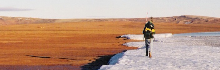
Returning to base camp along the shore of Tingmisut Lake, Melville Island, Canadian High Arctic, 1998.
(photo by Ian Fieldhouse)