David William Leverington
Random Field Photographs
All photographs (c) David Leverington, 1993-2017.
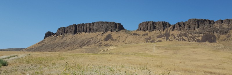
 Rhyolites of the Mahogany Mountain caldera, exposed in Dago Gulch, Oregon (August, 2017). These ~15.8-Ma units include rhyolitic dikes and ash-flow tuffs. Fieldtrip led by Mark Ferns, Martin Streck, and Jason McClaughry.

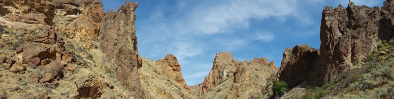
 Devils Gate rhyolite, Oregon (August, 2017). This prominent ~15.4-Ma lava flow overlies 17-Ma Bishops Ranch basalts, and was erupted from a vent located along the northeastern margin of the Three Fingers caldera. Fieldtrip led by Mark Ferns, Martin Streck, and Jason McClaughry.
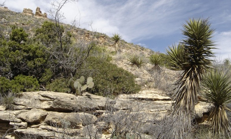
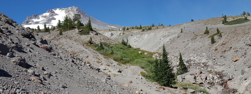 Partly vegetated ~130-ka andesite flow located on the southern flanks of Mount Hood, Oregon (August, 2017). Fieldtrip led by Willie Scott.
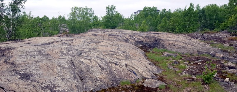 Archean pillow lava exposed in cross section by Late Wisconsinan glacial erosion, Rouyn-Noranda, Quebec (June, 2017). These 2.7 Ga units are part of the Blake River Group of the Abitibi subprovince, and formed on the ocean floor in an arc environment. The Abitibi subprovince is the largest greenstone belt in the world, and in the Rouyn-Noranda region contains substantial amounts of gold and copper in volcanic-hosted massive-sulfide deposits. Rock hammer near bottom-center for scale.
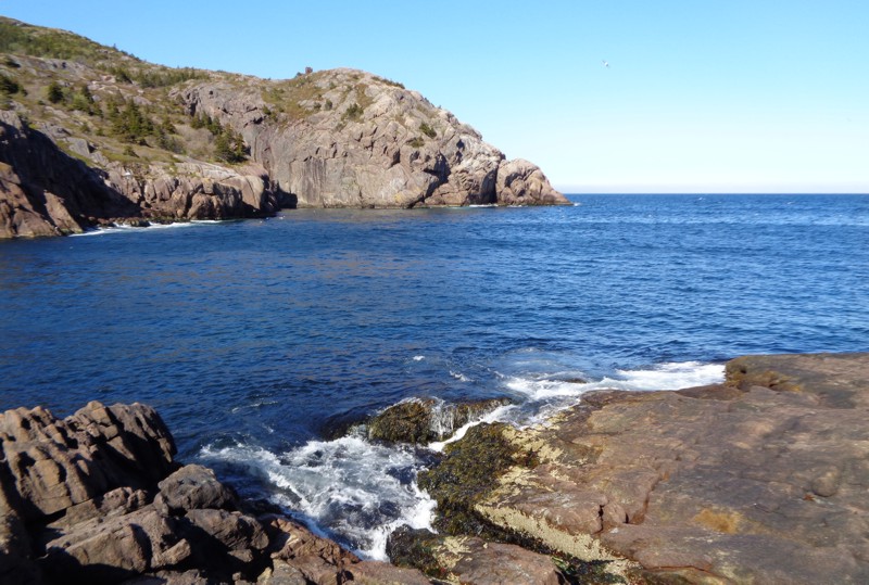 View of the entrance to Quidi Vidi Harbour, St. John's, Newfoundland (June, 2015). Rocks exposed here belong to the Late Proterozoic Cuckold Formation, which consists largely of red-weathering sandstone and conglomerate. These materials, and more generally those that comprise Newfoundland's Avalon Peninsula, once formed part of the microcontinent of Avalonia.
 View of Onaping Falls, Greater Sudbury, Canada (July, 2014). Here, the Onaping River spills over part of the rim of the Sudbury Basin, a structure which is interpreted to have been formed 1.85 billion years ago by a large meteorite impact. This impact is believed to have formed a crater as great as 250 km across. Among the bedrock units exposed in the vicinity of the falls are those of the Onaping Formation, which includes materials interpreted by many workers as fallback breccia. To the immediate north are exposures of rocks of the Sudbury Igneous Complex. Shatter cones, features that are generally considered diagnostic of past impact events, are abundant in the Sudbury region.
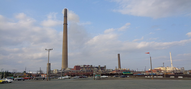 Inco Superstack, Sudbury, Canada (July, 2014). This enormous chimney is 380 meters high and sits upon a large nickel smelting operation originally run by Inco and later acquired by Brazilian mining company Vale. The chimney was constructed in order to allow the various byproducts of smelting to be dispersed beyond the city. Sudbury's nickel and copper operations are among the largest in the world.
 Red and pink outcrops of the 1.46 Ga Chief Lake Complex, a system of igneous intrusions located south of Sudbury, Canada (July, 2014). Component lithologies are dominated by granitoids, including quartz monzonite and granodiorite. The Chief Lake Complex is one of several plutons of the Southern Province that are located along the northwestern side of the Grenville Front.
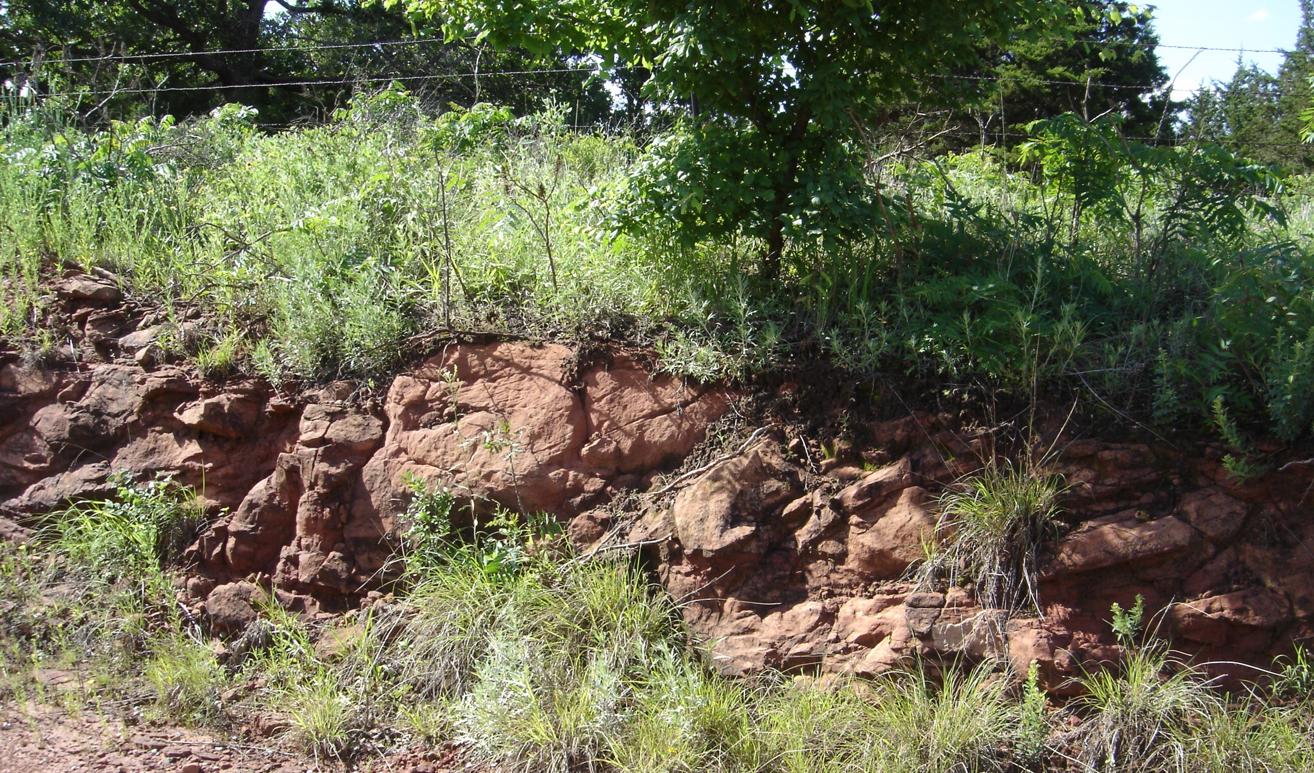 A small exposure of the Garber sandstone, northeast of Crescent, Oklahoma (June, 2013). These quartz-rich Permian redbeds were predominantly deposited in fluvial environments. Units are generally poorly cemented, and barite roses ("rose rocks") are relatively abundant.
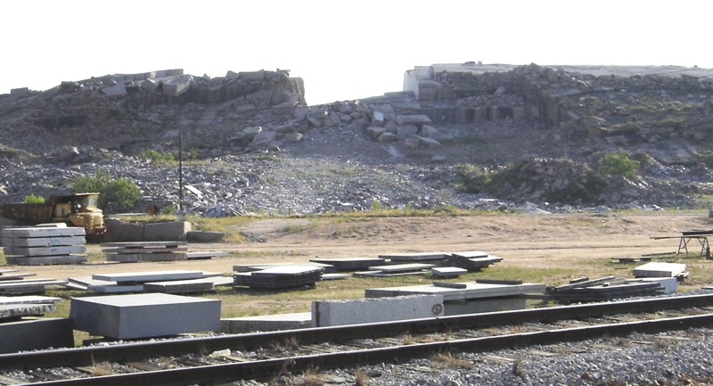 Granite Mountain, Marble Falls, Texas (June, 2012). This granite dome was a key source of materials used to build the Texas State Capitol Building in nearby Austin. Quarrying operations continue to this day and are presently conducted by the Minnesota-based Cold Spring Granite company.
 Exposure of Valley Spring gneiss near the Devil's Waterhole, Inks Lake State Park, Texas (June, 2012). The Valley Spring gneiss is of Middle Proterozoic age and was metamorphosed during Grenville orogenesis.
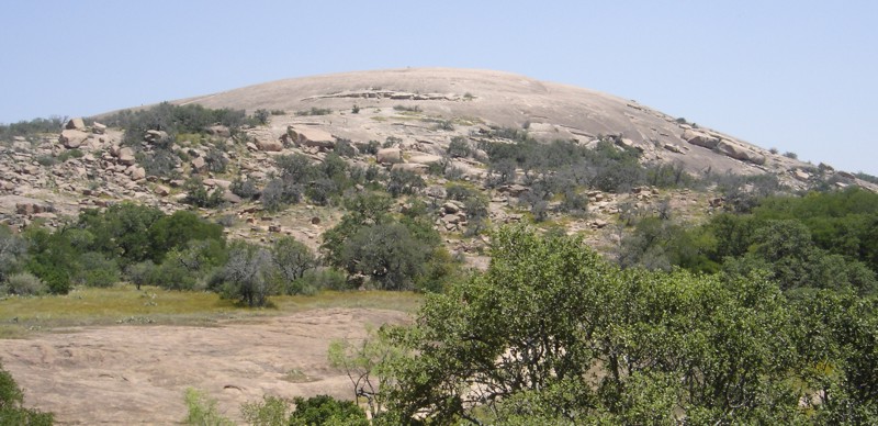 Enchanted Rock is the domal surface expression of a granite body that was intruded into ancient metamorphosed sedimentary rocks of the Llano region of central Texas. This dome represents only a small part of the Town Mountain granite, which was intruded over one billion years ago into local units including the Packsaddle schist and Valley Spring gneiss. Past uplift of the Llano region, which may have been associated with the Ouachita orogeny, ultimately resulted in the widespread exposure of Precambrian units in central Texas. These units continue to be exhumed in the region through erosion of overlying sedimentary units of Paleozoic and Mesozoic age. Enchanted Rock is located in the Enchanted Rock State Natural Area, situated between the cities of Llano and Fredericksburg (June, 2012).
 Bedrock forms the floor of this reach of the Pedernales River, located in Pedernales Falls State Park, Texas (June, 2012). These limestones are of Pennsylvanian age and are inclined in the direction of water flow, resulting in the formation of a series of pools separated by low-angle "falls" that flow across exposed bedding planes. Periodic flood events are substantially responsible for the scouring of bedrock here, forming prominent erosional features such as large potholes.
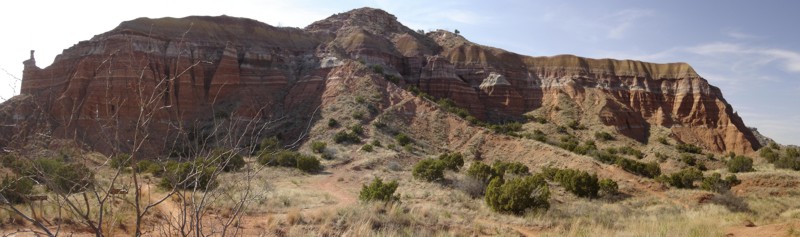
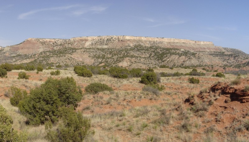 Fortress Cliff, Palo Duro Canyon State Park, Texas (March, 2011). From peak to base, bedrock units include the Ogallala Formation (Miocene / Pliocene), Trujillo Formation (Triassic), Tecovas Formation (Triassic), and Quartermaster Formation (Permian) [though the lower units are mostly covered with talus here].
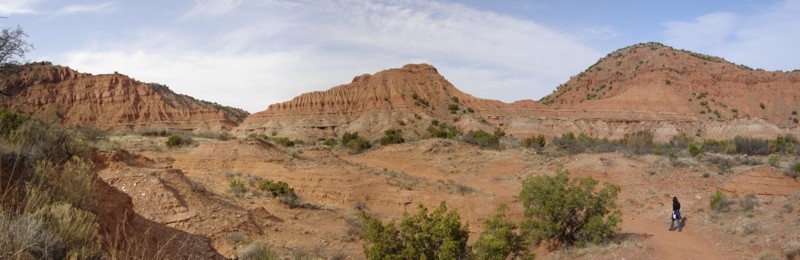
 Capitol Peak, Palo Duro Canyon State Park, Texas (March, 2011). Preserved bedrock units mainly belong to the Tecovas Formation (Triassic) and Quartermaster Formation (Permian).
 Permian redbeds of Caprock Canyons State Park, Texas (March, 2011).
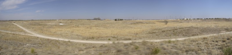 Yellow House Draw, Lubbock Lake Landmark, Texas (March, 2011). Part of the Brazos drainage system, this subtle feature is of great archeological significance, having been occupied by humans for at least the last 11,000 years.
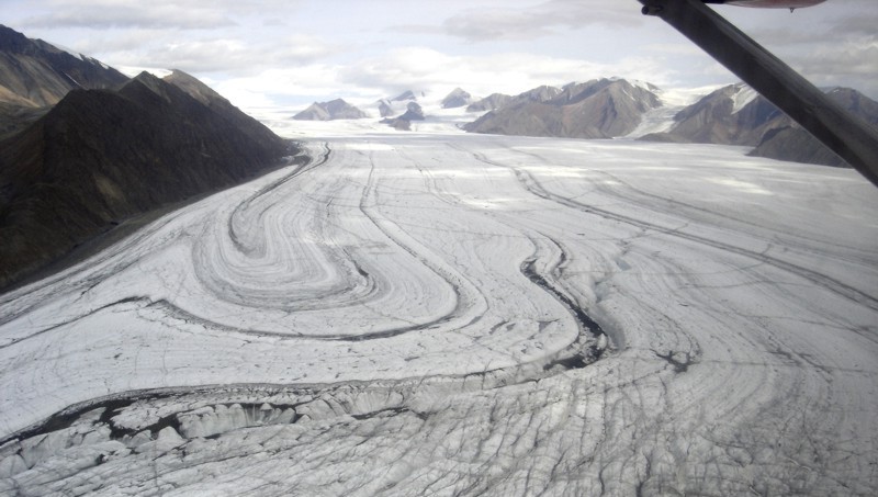 Thompson glacier as viewed from a Twin Otter, Axel Heiberg Island, Canadian High Arctic (July, 2010).
 Rebecca Ghent and Larry Roy (U.Toronto) survey the subsurface near valley exposures of Jurassic and Cretaceous sedimentary units, Ellesmere Island, Canadian High Arctic (July, 2010).
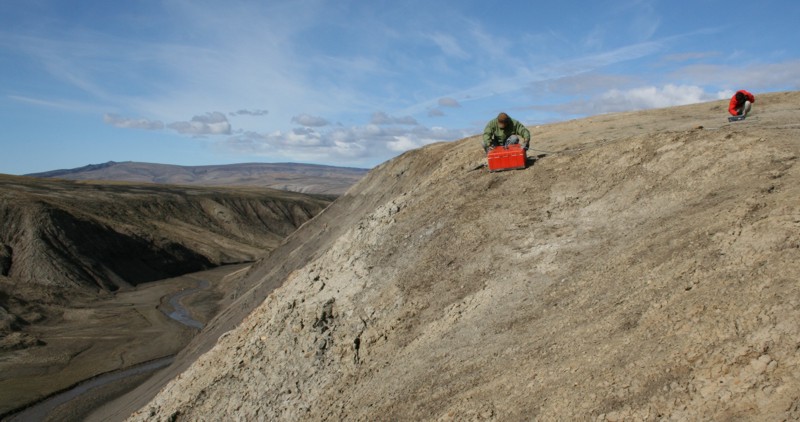
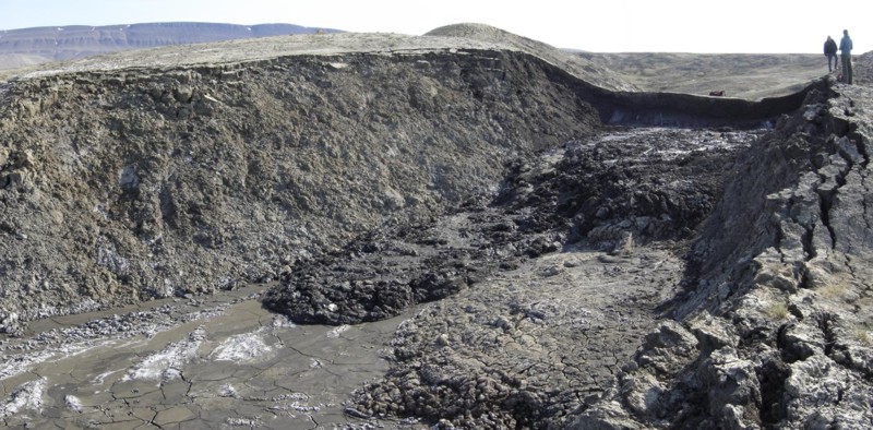 Wayne Pollard (McGill U.) and Laura Thomson (U. Western Ontario) examine a small retrogressive thaw slump near Eureka, Ellesmere Island, Canadian High Arctic (July, 2010).
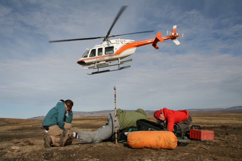 Helicopter drop-off south of Slidre Fiord, Ellesmere Island, Canadian High Arctic (July, 2010). Bracing the field equipment are Laura Thomson (U. Western Ontario), Larry Roy (U.Toronto), and Rebecca Ghent (U.Toronto); the pilot is John Innis.
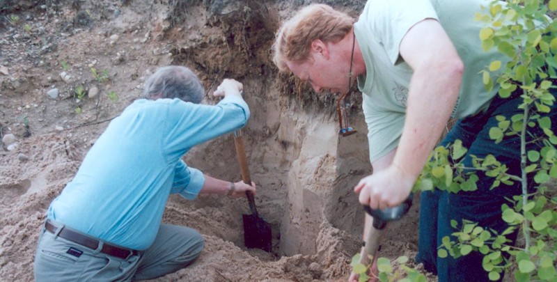
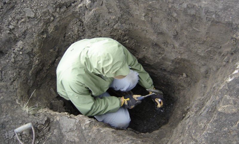 Larry Roy (U.Toronto) chips away at ice-rich ground in a ~1 m deep pit located at a therokarst site near Eureka, Ellesmere Island, Canadian High Arctic (July, 2010). Holocene marine sediments are well exposed in this pit, making up most of the active layer materials here.
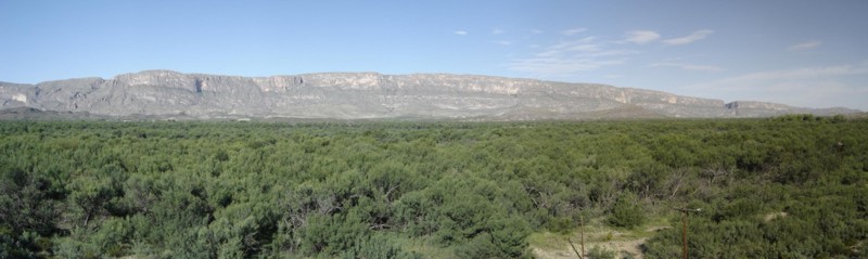
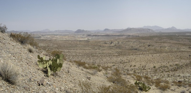 Eastward view from Rattlesnake Mountains, Big Bend National Park, Texas (May, 2008). The clastic and carbonate units in the foreground are mainly of Cretaceous age. This region is part of the Chihauhauan Desert, which straddles much of the U.S.-Mexico border.
 Hunt's Hole, a volcanic maar in the Potrillo Volcanic Field of southern New Mexico (May, 2008).
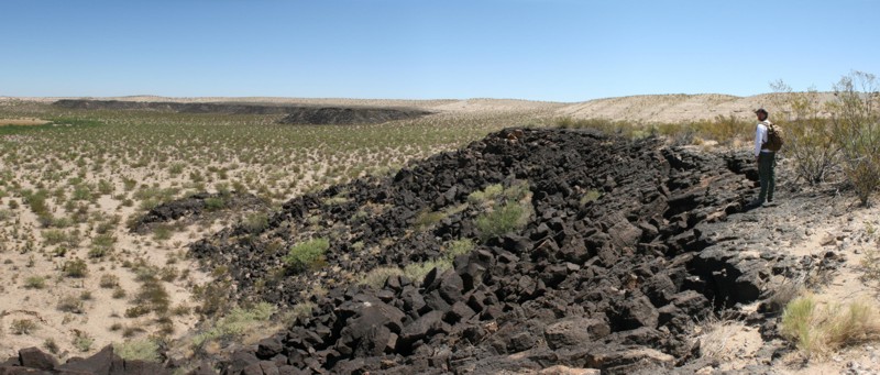
 Cones of Potrillo Volcanic Field, southern New Mexico (May, 2008).
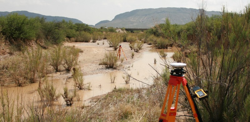 Past work at Big Bend National Park required the use of differential GPS techniques for precise determination of site positions (May, 2008).
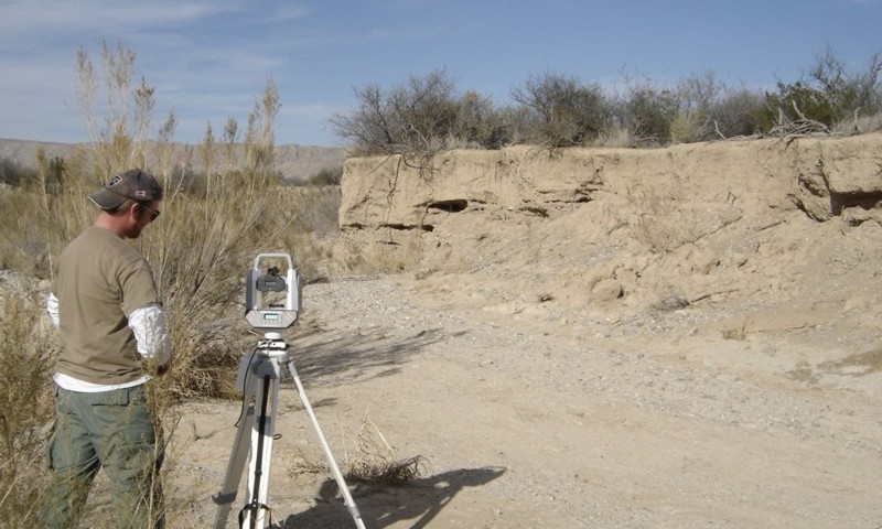 Graduate student Jeremiah Kokes conducts laser scanning of the banks of Nine Point Draw, an arroyo located in northeastern Big Bend National Park, Texas (December, 2007). Repeat generation of centimeter-scale morphological models can allow for the quantification of the rates of a range of geomorphological processes.
 Sierra Ponce cliffs, Mexico (June, 2007). The cliffs run along the Rio Grande up to Santa Elena canyon, the notch visible at right. In the foreground are forests mainly located on the Texas side of the Rio Grande.
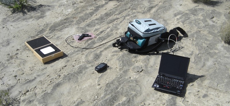 Equipment used to characterize the reflectance properties of field materials. At left is a highly reflective lambertian surface used for system calibration. The spectrometer (an ASD FieldSpec3) sits in a backpack for easy transportation. Measurements are made using a small handheld scope attached to the spectrometer by fibre optic cable, with the spectrometer itself controlled by a small laptop computer.
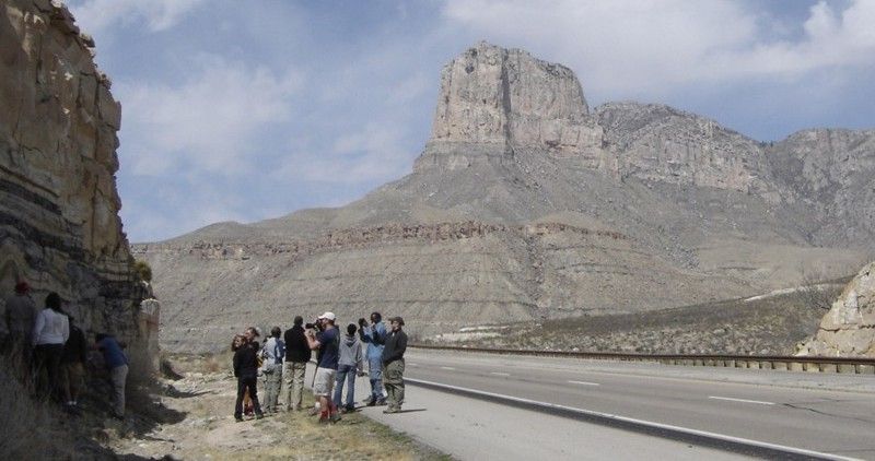 El Capitan (at back), a well-preserved Permian reef in Guadalupe Mountains National Park, Texas (March, 2007). The outcrop at left is comprised of offshore clastic sand bar units that are also of Permian age. This photo was taken on a TTU field trip led by Professor Pete Holterhoff.
 Hillslope near Sitting Bull Falls, Lincoln National Forest, New Mexico (March, 2007).
 Buttes at Guadalupe Mountains, New Mexico (March, 2007).
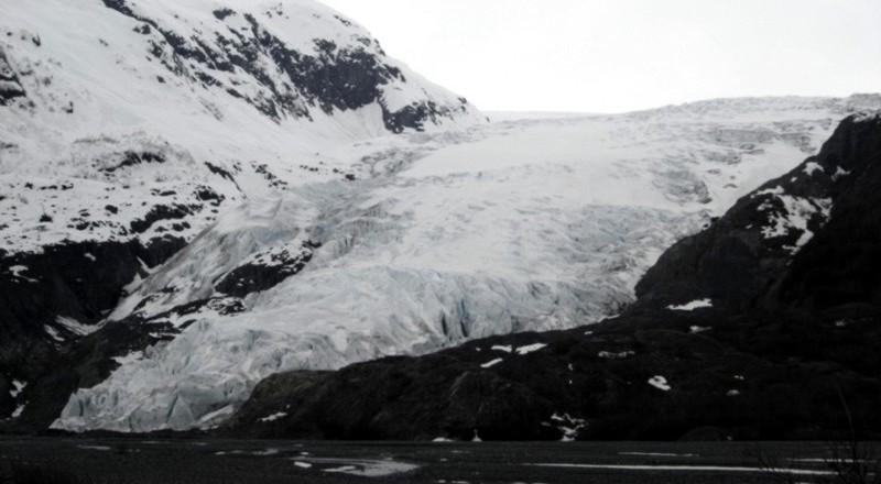 Exit Glacier, Kenai Fjords National Park, Alaska (May, 2006). This glacier is readily accessible by highway from the Seward area.
 Rattlesnake Mountains, Big Bend National Park, Texas (April, 2006).
 Cretaceous limestones exposed in a roadcut near the town of Fluvanna, Texas (March, 2006). This photo was taken on a field trip led by Professor George Asquith.
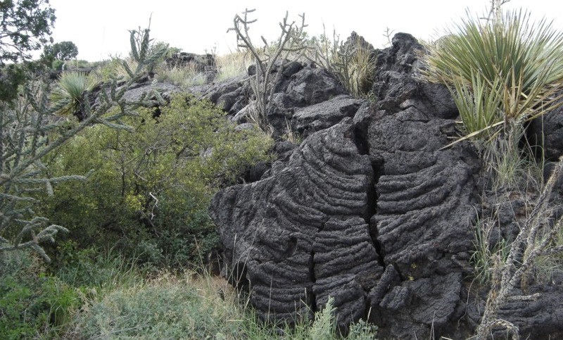 Ropy pahoehoe texture associated with the Malpais basalt flows, Valley of Fires, south-central New Mexico (June, 2006). These flows are located west of Carrizozo, New Mexico.
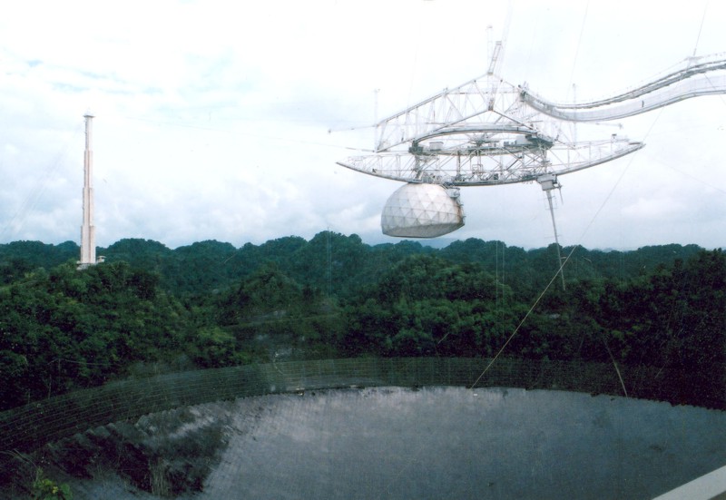 Arecibo Observatory, Puerto Rico (August, 2004). This is a large radio telescope that is used for atmospheric research and radio astronomy, and is also used as a radar for imaging objects in our solar system.
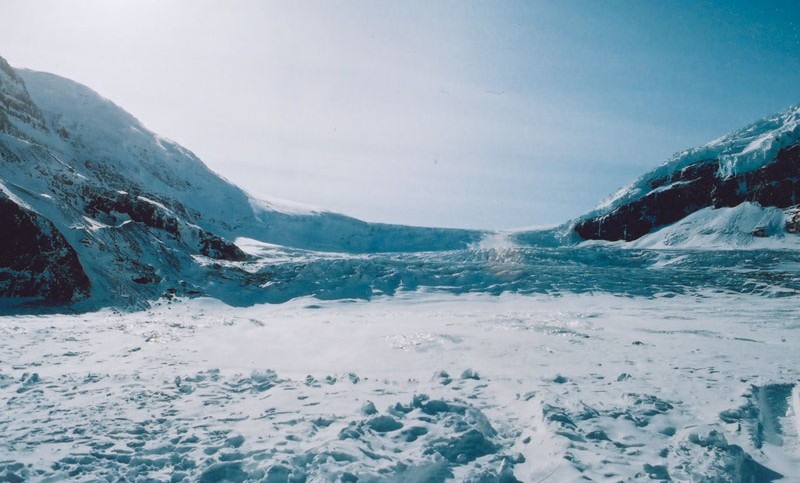 Athabasca Glacier, located in the Rocky Mountains of Alberta, Canada (fall, 2003). This glacier is fed by the Columbia Ice Field, visible on the horizon. The glacier is easily accessed by highway and trail.
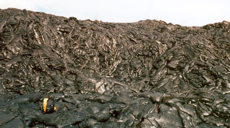 Coalescing pahoehoe toes associated with basalt flows at Kilauea, Hawaii (March, 2002).
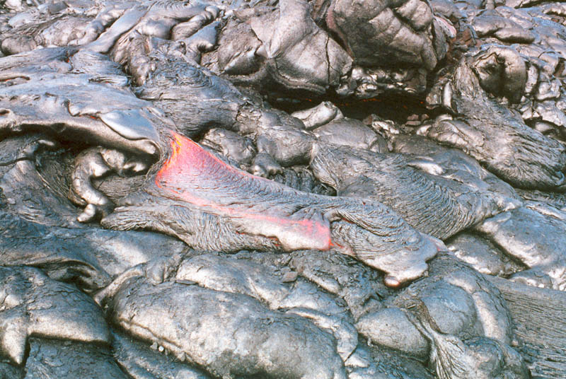 New pahoehoe toes on the flanks of Kilauea (March, 2002). The active flow here is ~1 m across.
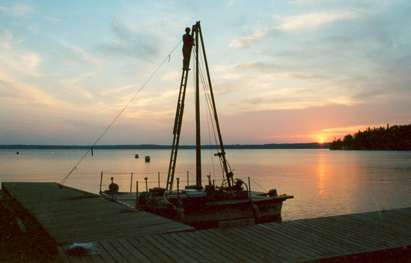 Evening view of the drill platform used in the summer of 2001 to core Quaternary sediments of West Hawk Lake, an impact crater located in Whiteshell Provincial Park, southeastern Manitoba, Canada. The lake is relatively deep (115 m), which makes coring efforts challenging. The coring campaign was conducted by Jim Teller (U.Manitoba) and a team of researchers based at the Limnological Research Center of the University of Minnesota, Deluth.
 Collecting samples from the preserved beaches of glacial Lake Agassiz, southern Manitoba, Canada (summer, 2001). Hard at work are Jim Teller (U.Manitoba) and Gaywood Matile (Manitoba Energy and Mines). Beaches such as these are preserved across much of central North America, and record aspects of the complex history of what is believed to have been the largest lake in North America during the last deglaciation.
 Sampling beach sediments of glacial Lake Agassiz near Wampum, Manitoba, Canada (summer, 2001). From left to right are Ron Goble (U.Nebraska Lincoln), Jim Teller (U.Manitoba), and Gaywood Matile (Manitoba Energy and Mines).
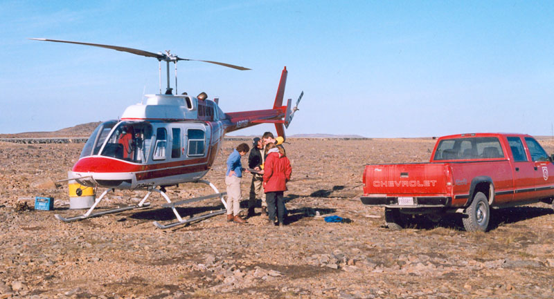 Loading the helicopter in preparation for fieldwork near Lac Watts, northern Quebec, Canada (summer, 1999). Logistical support was provided by Falconbridge. Photo by Ian Fieldhouse.
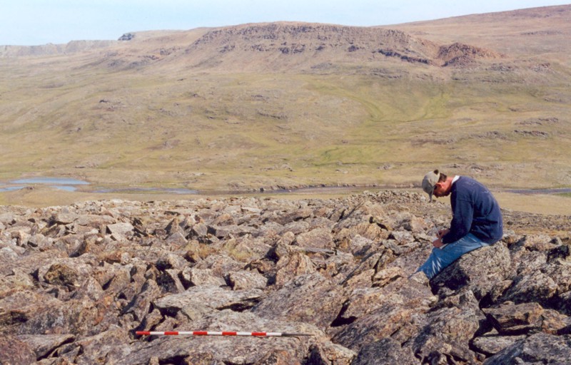 A landscape dominated by materials of the Purtuniq ophiolite, preserved paleoproterozoic oceanic crust (2 Ga) located in northern Quebec, Canada (summer, 1999). The Purtuniq complex is part of the Cape Smith Belt, which itself is part of the Trans-Hudson orogen, an orogenic suture that extends across the North American craton. This region was visited to collect rock, soil, and vegetation samples for the purpose of testing the utility of remote sensing techniques in mapping surface materials. In this photo, solifluction lobes are evident in unconsolidated hillslope materials, and a large peridotite outcrop is exposed at back. Photo by Ian Fieldhouse.
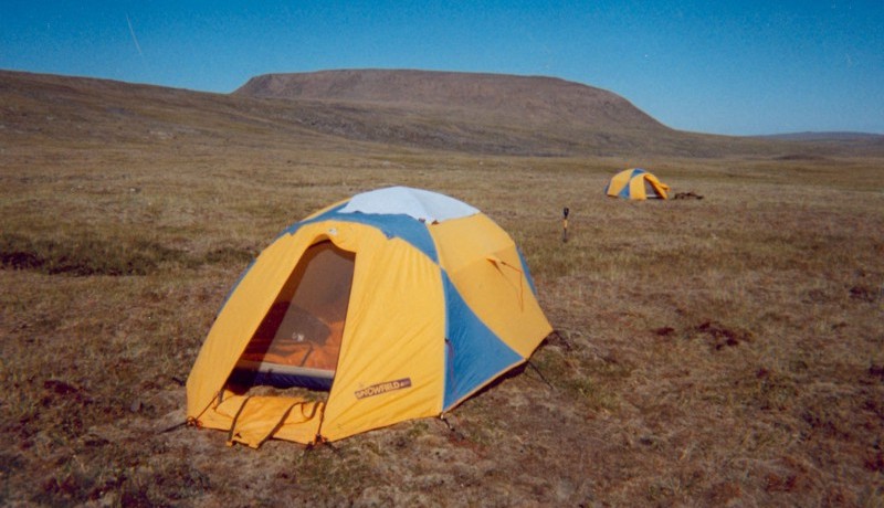 Camp site located several kilometers southeast of Lac Watts, Cape Smith Belt, northernmost Quebec, Canada (summer, 1999). A large (~1 km across) peridotite outcrop is exposed at back.
 Ian Fieldhouse stands by mess tent at camp site located southeast of Lac Watts, northernmost Quebec, Canada (summer, 1999).
 Helicopter view of cliff exposures of the Watts Group, northern Quebec, Canada (summer, 1999). The Watts Group forms part of the Purtuniq ophiolite, and consists of basalts, gabbroic sills, and sheeted gabbroic dykes. Lac Watts is visible at left.
 Walking among the basalts of the Chukotat Group, northernmost Quebec, Canada (summer, 1999). Photo by Ian Fieldhouse.
 Examining blocky exposures of basalts of the Chukotat Group, northernmost Quebec, Canada (summer, 1999). Photo by Ian Fieldhouse.
 Sabine Bay Formation sandstones and associated weathering products, Melville Island, Canadian High Arctic (July, 1998). This area was visited for the purpose of testing the utility of various remote sensing techniques in mapping rock, soil, and vegetation classes. Photo by Ian Fieldhouse.
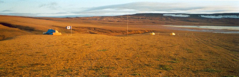 Base camp, Tingmisut Lake, Melville Island, Canadian High Arctic (July, 1998).
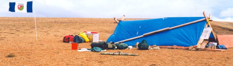 Improvised kitchen structure built from scrap wood, Tingmisut Lake region, Melville Island, Canadian High Arctic (July, 1998).
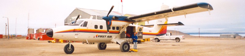 Loading a Twin Otter at Resolute, Cornwallis Island, Canadian High Arctic (Ian Fieldhouse in blue) (July, 1998).
 Resolute, Cornwallis Island, Canadian High Arctic (July, 1998). The airport at Resolute is a key logistical center of the High Arctic.
 Southward view from Keno Hill, central Yukon Territory, Canada (May, 1998). This region forms part of the northernmost extent of the Yukon Plateau, and was once actively mined for silver ore.
 Hudson Bay shoreline near Churchill, Manitoba, Canada (summer, 1997). Exposed materials in this photo are mainly bedrock, but the numerous well-preserved raised beaches of the region document the flooding and glacioisostatic uplift of the region since the time of deglaciation.
 Raised beaches on Hudson Bay near Churchill, Manitoba, Canada (summer, 1997). Differential glacioisostatic rebound continues to take place in this region.
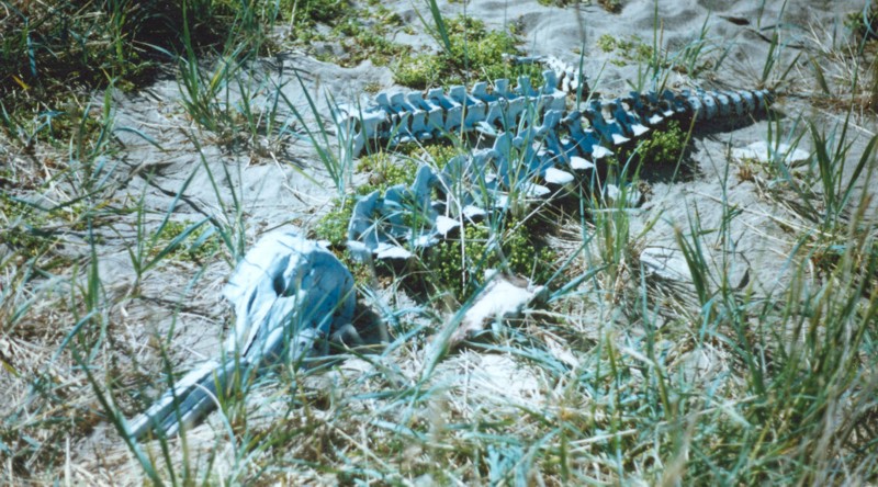 Skeleton of a beluga whale on the shoreline of Hudson Bay near Churchill, Manitoba, Canada (summer, 1997).
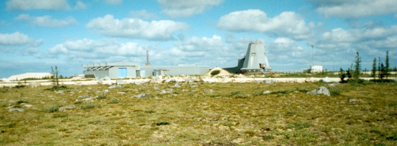 The Fort Churchill rocket launch site, located on the shore of Hudson Bay near Churchill, Manitoba (summer, 1997). Though now inactive, this site has been used in the past as a launching range for suborbital sounding rockets.
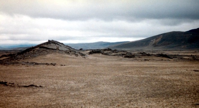
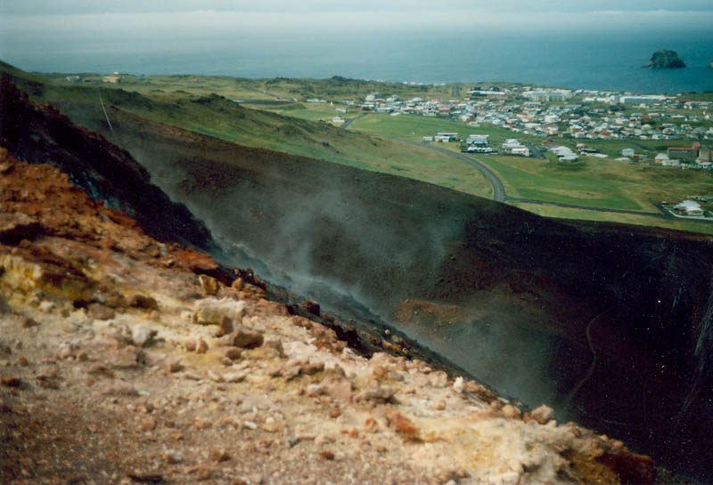
 Laki fissure, southern Iceland (summer, 1996). This fissure is part of the volcanic system that erupted about 15 cubic kilometers of basaltic magma over an eight-month period in 1783-84.
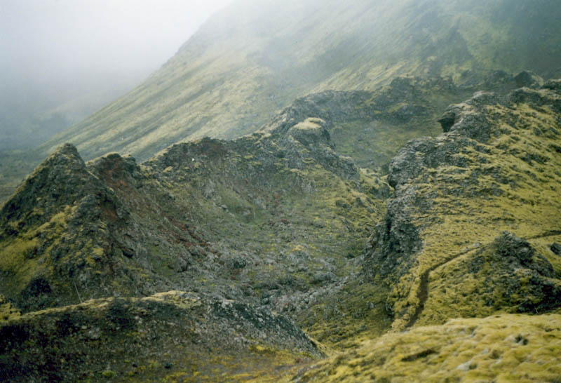
 Tumulus landform in basaltic lava flows, central Iceland (summer, 1996).
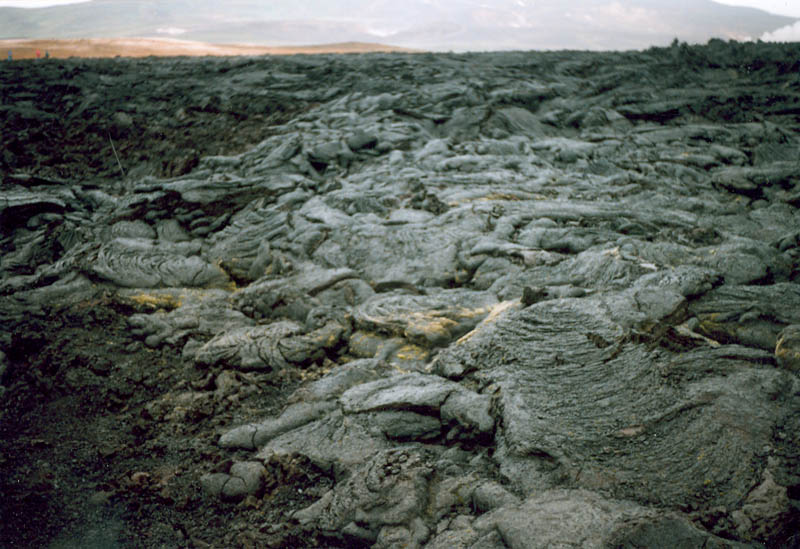 Pahoehoe units comprised of lava toes as well as surface flows with ropy and shelly characteristics, Krafla caldera, northeastern Iceland (summer, 1996).
 The scoria-covered flanks of Eldfell, a cinder cone formed on the island of Heimaey in the 1970's (summer, 1996). Heimaey is the largest of Iceland's Vestmannaeyjar Islands.
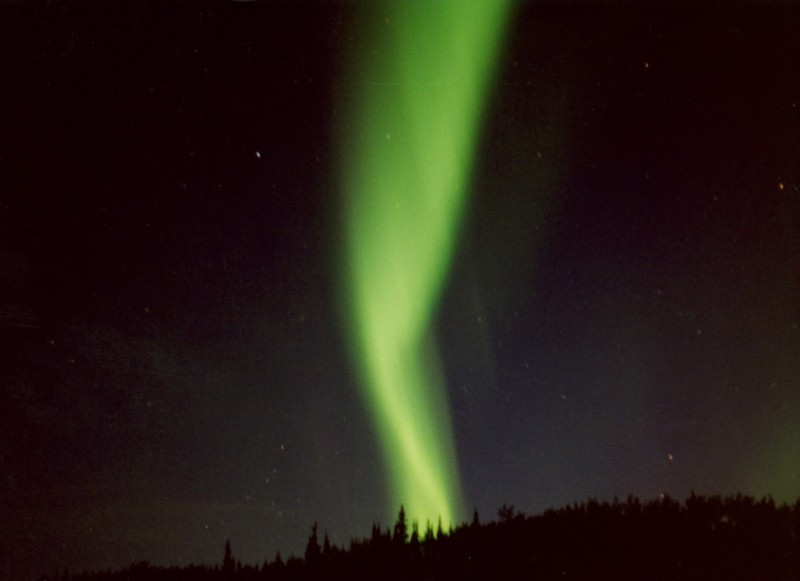 Aurora borealis as viewed from Mayo, Yukon Territory, Canada (late August, 1994).
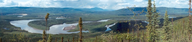 Stewart River and village of Mayo, central Yukon Territory, Canada (summer, 1994). This region of the boreal forest is within the zone of discontinuous permafrost. There is a relatively strong correlation here between vegetation classes and near-surface permafrost conditions, with the spruce trees of flat or north-facing slopes typically associated with shallow (<1.5 m) permafrost tables.
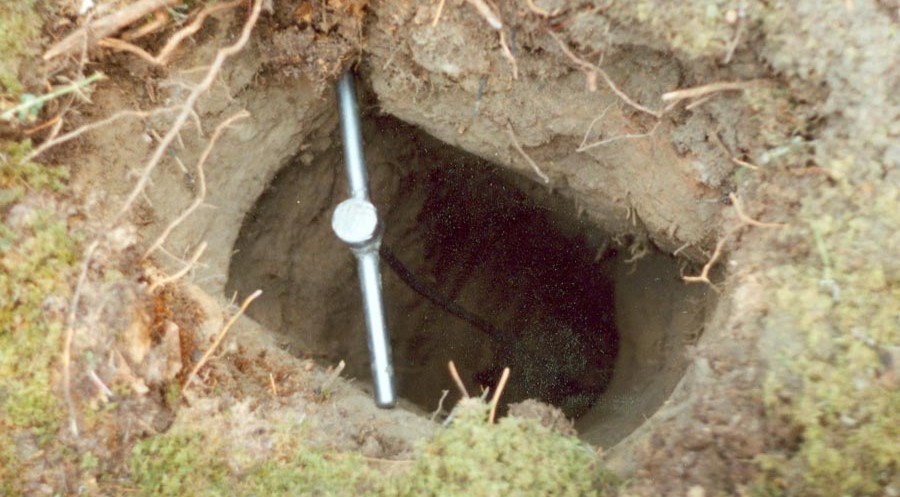 One of more than 460 shallow (<1.5 m) pits dug in July and August of 1994 as part of an active-layer survey near Mayo, Yukon Territory, Canada.
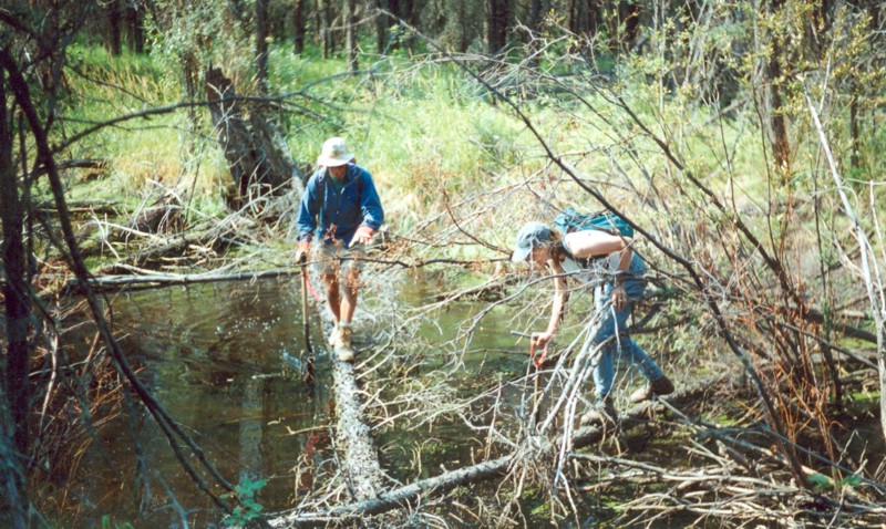 Phil Wilson and Geraldine Bergmans make their way through the boreal forest of Stewart River Valley, central Yukon Territory, Canada (summer, 1994).
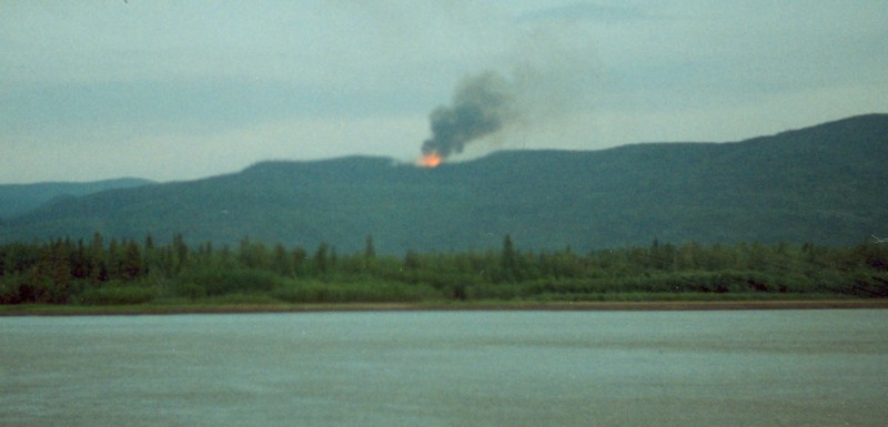 Forest fire along the flanks of Stewart River Valley, central Yukon Territory, Canada (summer, 1994). A lightening strike started the fire about 15 minutes before this photo was taken.
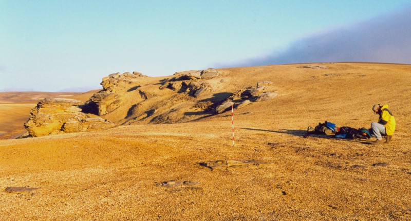
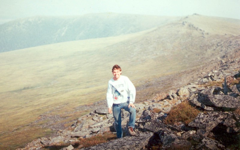 Standing on the windy peak of Hungry Mountain, central Yukon Territory, Canada (summer, 1994). The view is partly obscured by smoke from a nearby forest fire.
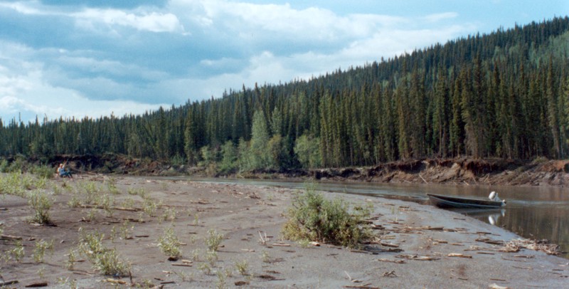 Point bar on Stewart River, central Yukon Territory, Canada (summer, 1993).
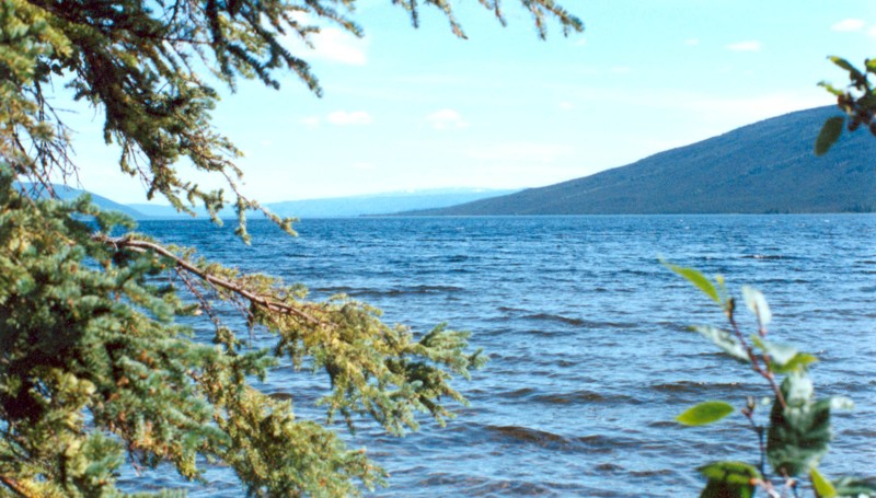 Ethel Lake, central Yukon Territory, Canada (summer, 1993).
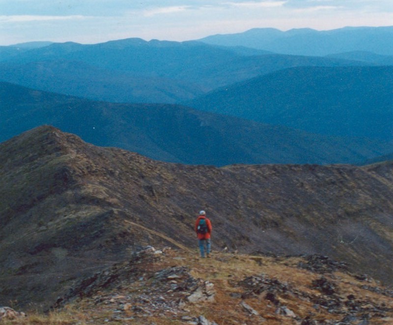 Geraldine Bergmans descends Mount Haldane, central Yukon Territory, Canada (summer, 1993). Mount Haldane is located west of the highway that links the villages of Mayo and Elsa.
All photographs (c) David Leverington, 1993-2017.